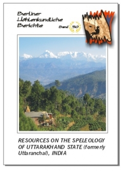
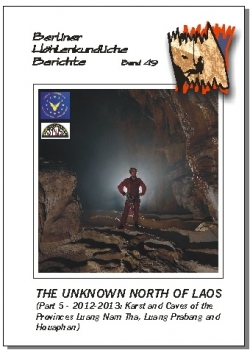
Berliner Hohlenkundliche Berichte (BHB) - pg. 2 including Resources on the Speleology of Uttarakhand State (formerly Uttaranchal), India.BHB Volume 50 Special Order
Due to shipping limitations and current international trade factors, we are not able to process special orders at this time. Inquire for availability for our existing stock. We are currently unable to reorder this series for our stock.
A Publication of the Speläoclub Berlin. The monographic series, "Berliner Höhlenkundliche Berichte" is released on an occasional basis. Series editor Michael Laumanns. The most comprehensive and consistently published source for reports on worldwide caving expeditions and digests of current speleological inventory and exploration information in the English language.
The complete series is available through Speleobooks. Please inquire if there are titles on the list which you are interested in that we do not have individually listed in our catalog.
2024
Volume 89: Malaysian Cave Bibliography
Volume 88: Philippines, Mindanao 2014–2023
Volume 87: India, Nagaland Expedition 2022–23
2023
Volume 85–86: Southeast Asia Atlas, 3rd Edition
Volume 84: Myanmar 2016–2020
2022
Volume 83: Middle East Atlas
Volume 82: Central African Republic
2021
Volume 81: Taiwan
2020
Volume 80: Sri Lanka
Volume 79: Republic of Congo and central/northern Gabon
Volume 78: Brazil, Serra da Bodoquena
2019
Volume 77: Cambodia 1995/96–2017
2018
Volume 76: Cambodia 2017 and 2018
Volume 75: Myanmar 2014–2017
Volume 74: South Vietnam, part 3 (Krong No Volcanic Geopark)
2017
Volume 73: Gabon (Central Africa)
Volume 72: Iran Ghar Alisadr & Ghar Katalehkhor
Volume 71: Mozambique (East Africa)
Volume 70: Cambodia 2017 (ersetzt durch Band 77 / replaced by volume 77)
Volume 68–69: Africa Atlas, 3rd Edition
2016
• Volume 67: Meghalaya, part 7 (Khaddum)
• Volume 65–66: Southeast Asia Atlas, 2nd Edition
• Volume 64: Cambodia 2016
• Volume 63: Northern Laos, part 6
• Volume 62: Gabon and Mozambique
• Volume 61: Philippines (Mindanao and Luzon Islands)
2015
• Volume 60: India, Meghalaya, part 6, Lumshnong
• Volume 59: Indonesia APS 1985–2001
• Volume 58: Albanian Alps
• Volume 57: Malaysia Cave Bibliography
2014
• Volume 56: south Vietnam, part 2
• Volume 55: Vietnam, Ninh Binh province
• Volume 54: Malaysia Cave Register
2013
• Volume 53: Africa, Democratic Republic of the Congo
• Volume 52: India, Meghalaya, Part 5
• Volume 51: Myanmar — 2011–2013
• Volume 50: India — Uttarakhand
• Volume 49: Northern Laos Part 5
2012
• Volume 47–48: India, Meghalaya, Part 4 (East Khasi Hills)
• Volume 45–46: Iran Cave Directory (3rd Edition)
2011
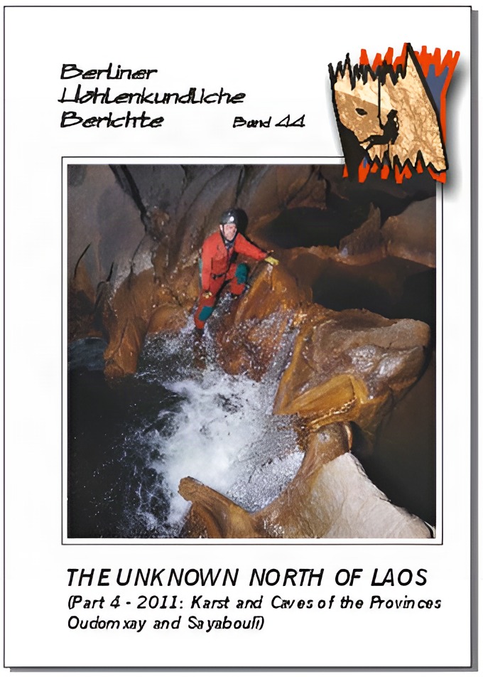
• Volume 44: Northern Laos Part 4
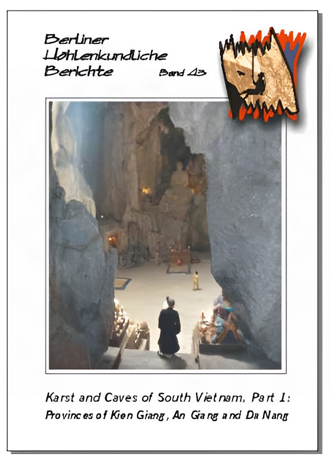
• Volume 43: South Vietnam Part 1
• Volume 42: India — Meghalaya Part 3 (West Khasi Hills)
2010
• Volume 40–41: Southeast Asia Atlas (ersetzt durch Band 65–66 / replaced by volumes 65–66)
• Volume 39: Myanmar Monography
• Volume 38: Northern Laos Part 3
2009
• Volume 37: Iran Cave Directory (2nd Edition) (ersetzt durch Bnde 45–46/ replaced by volumes 45–46)
• Volume 36: Gabon (Central Africa)
• Volume 35: India — Meghalaya Part 2 (Garo Hills)
• Volume 34: Cambodia (Battambang)
2008
• Volume 33: India — Meghalaya, Part 1 (Overview)
• Volume 32: Northern Laos Part 2
• Volume 31: Kenya Mt. Suswa caves
• Volume 28–30: Africa Atlas 2nd edition (ersetzt durch Band 68–69 / replaced by volumes 68–69)
• Volume 27: India — Madhya Pradesh
• Volume 26: Iraq
• Volume 25: Russia – Caucasus (Bol’shoj Tkhach)
2007
• Volume 24: Africa Atlas Update 2 (ersetzt durch Band 28–30 / replaced by volumes 28–30)
• Volume 23: Rwanda 2nd Edition
• Volume 22: Vietnam (North)
2006
• Volume 21: India – Himachal Pradesh
• Volume 20: Yemen – Soqotra Island
2005
• Volume 19: India – Rajasthan …
• Volume 18: India – Kashmere …
• Volume 17: Africa Atlas Update 1 (ersetzt durch Band 28–30 / replaced by volumes 28–30)
• Volume 16: Northern Laos Part 1
• Volume 15: Rwanda Supplement 1 (ersetzt durch Band 23 / replaced by volume 23)
2004
• Volume 14: Afghanistan
• Volume 13: Madagascar
• Volume 12: Iran – Ghar Katalehkhor
• Volume 11: Rwanda (ersetzt durch Band 23 / replaced by volume 23)
2003
• Volume 10: Iran Cave Directory (ersetzt durch Band 37 / replaced by volume 37)
2002
• Volume 7–9: Africa Atlas 1–3 (ersetzt durch Band 28–30 / replaced by volumes 28–30)
S. F. M. Breitenbach & H. D. Gebauer: 199 pp., colour photo tables and maps, many surveys; Berlin 2013. This is our first anniversary volume! It has in-depth descriptions of over 350 cave/karst sites and also includes the historical surveys of the British expeditions in the 1940ties led by E.A.Glennie. Too many caves are unmapped yet. Consequently, this publication is a unique source for future explorers striving for improvements. In English language.
J. Dreybrodt & M. Laumanns (Eds.): The Unknown North of Laos. (Part 5 - 2012-2013: Karst and Caves of the Provinces Luang Nam Tha, Luang Prabang and Houaphan). - 150 pp., colour photo tables, many maps & surveys; Berlin 2013. This volume presents the results of the 2012 and 2013 International Expeditions to Northern Laos and describes a total of 27 km of passages from 95 caves, all of which are represented by a detailed survey. Includes Tham Doun Mai (3,745 m) and Tham Nam Oogh (3,140 m). In English with German and French abstracts.
By Herbert Daniel Gebauer. 430 p., countless maps and cave surveys; Berlin 2012. BHB publications 47 & 48. The "bible" on karst and caves of the East Khasi Hills and the Ri Bhoi district in Meghalaya/India. Alphabetical cave directory of far over 700 caves descriptions. Longest cave is Krem Mawkyhrdop (Mawmluh) at 7.2 km. An incredible source for future expe-ditions as many caves in the East Khasi Hills are still unsurveyed. Vol. 47 has 210 pages and contains the introduction, geological settings, thorough area descriptions as well as the 1st part of cave registry. Vol. 48 provides, on 220 pages, the 2nd part of the registry, cave lists, maps, and references. In English.
By Ezzatollah Raeisi; Sharareh Ghazy & Michael Laumanns: 315 pp., many surveys and colour maps; Berlin 2012. This is by far the most extensive reference on karst and caves of Iran. Introduction: Geological and tectonic settings, state of speleology in Iran, general explanations. Many cave surveys. Rankings according to length and depth. Geological map.
The main section of the book lists and describes, in the form of a table with over 2,000 lines, all caves, which became known up till now in Iran — obtained to a great part by the translation of Persian sources, which are inaccessible in the Occident. Has even more caves as all existing Iranian cave registries. Detailed list of references. In English language, with abstracts in Farsi and German.
Vol. 45 covers: introduction & cave registry according to names (184 p.).
Vol. 46 covers: cave registry according to provinces, rankings, references, surveys, geological map of Iran (131 p.).
The 3rd edition of the Iran Cave Directory is based on volumes 10 and 37 of this publication series, which were released in the years 2003 and 2009 and described more than 850 cave locations. This edition increases the number of described caves to over 2,000. As a result, the number of caves by far exceeds all previously compiled Iranian cave lists, apparently even those available in Iran itself. Although due to the political circumstances the possibilities for foreigners to conduct karst research in Iran are somewhat limited a number of explorative projects have taken place since 2009. In 2011 the Iranian Cavers and Speleologists Association (ICSA) was founded, which currently has more than 100 members from all over Iran. A significant factor in the progress made regarding the number of caves presented below is due to the amazing cave registry of Shary Ghazy. This invaluable resource along with a significant amount of information provided by Mr. Davoud Mohammadi–far, a survey of Farsi websites, and access to publications of an older date, all of which were made available for this edition. The likelyhood of additional information being available in the future will no doubt lead to updated editions of the Iran Cave Directory.
In the course of my own speleological investigations in Iran it was realised that a significant number of Iranian publications exist that deal with speleology in general and cave locations in detail. What they all have in common is that they are written in Farsi, a language unique in writing style and spoken in Iran and some of the neighboring countries exclusively. It is regarded to be a useful contribution to speleology to make all this information on the state of cave research in Iran known to international circles. The following list should encourage speleologists and karstologists to visit Iran and to raise the level of knowledge on Iranian caves. Iran has special entry regulations. It is not possible for individuals to enter the country without an official invitation and a formally granted visa permission. Hence, it is strongly recommended to officially apply to an official institution (like a university) for a joint project that implies state of the art surveying work, the delivery of a quality report for the Iranian project partners and an adequate respect for the culture of the host country. On this basis caving in Iran will certainly be an impressive experience and of sustainable benefit for all participants.
110 p., colour photo tables, many maps and surveys; Berlin 2011. Jorg Dreybrodt & Michael Laumanns (Editors). Presents the results of the 2011 international expedition to northern Laos. 11,7 km of cave passage from 16 caves. Includes final survey of the the new longest cave of northern Laos (Tham Chom Ong System), which is also the 3rd longest cave of Laos and the currently 10th longest cave of SE Asia at 17,150 metres. Three caves of Sayabouli province exceed 1 km in length, including the underground river of Tham Nam Lot (3,560 m). In English language with a German and French abstract. Before the publication of Dreybrodt & Laumanns (2005a), which sumarises the exploration conducted between 2000 and 2005, northern Laos was virtually unknown to speleologists. Only a few reconnaissance projects were conducted prior to 2000 in the province of Luang Phrabang. The afore-mentioned publication provided information on 24.3 km of cave passages from 68 caves. In the framework of the "Northern Lao-European Cave Project" (www.laoscaveproject.de) the investigations were continued in 2006-2008 (Luang Nam Tha and Houaphan provinces) (Dreybrodt & Laumanns 2008). Further findings from 2009-2010 in the Houaphan and Oudomxay provinces were published by Dreybrodt & Laumanns (2010b). This publication reports on the findings of the year 2011 (Oudomxay and Sayabouli provinces) , including the final survey of the 17,150 m long Tham Chom Ong System (Oudomxay). The cave system is the currently 3rd longest cave of Laos as well as the 10th longest cave of Southeast Asia. This report comprises descriptions of 21 caves with 11,696 km of new passages. Overall, 92 km of cave passages from 196 caves has been surveyed and published to date from northern Laos (excluding Vang Vieng and Kasi).
107 p., colour maps, photos, tables, and many surveys; Berlin 2011. Michael Laumanns (Editor). This volume presents the 2010 and 2011 German-British cave projects expedition to South Vietnam and mainly covers the karst of Ha Tien-Hon Chong as well as the Marble Mts. south of Da Nang. This volume describes a total of 4,318 m of underground passages from over 60 caves in detail, the longest of which is Hang Moi Chau (1,003 m long), together with an in-depth chapter of the biospeleology of South Vietnam. In English with abstracts in German, French and Vietnamese. Spectacular karst and large caves are known from central and northern Vietnam, e.g. in the Phong Nha/Ke Bang area (Laumanns 2010b). However, the small caving areas of southern Vietnam, developed not only in carbonate karst but also in volcanic and granite rocks, have not attracted many speleologists up to now. Apart from biospeleological and a few touristic activities (Addis 1970, Deharveng et al. 1995, Price 1995) the rich diversity of caves in south Vietnam (Ha Tien/Hon Chong area in Kien Giang province) was first investigated systematically by a German-British team in 2010, followed by a 2011 lightweight German-British expedition to Kien Giang and Da Nang provinces. This has resulted in the present publication, which describes more than 60 caves with a total of 4,318 metres of surveyed underground passages. This publication strives to encourage other speleologists to continue with cave exploration in south Vietnam as this compilation is regarded as being far from complete with regard to the karst and caves of south Vietnam.
120 pages, colour photo tables, many surveys and colour maps; Berlin 2011. Herbert Daniel Gebauer (Editor). The stand of play on this exciting and still relatively unexplored major karst area in NE India. 164 karst sites and caves are presented in detail, the longest of which is Morasora Rongkol (Bagli District) at 5,829 m. As most of the known caves are still unsurveyed this compilation is an invaluable source for future speleological documentation in the West Khasi Hills. The geological settings and the references are covered by volume 33 of this series.In English language.
NFS replaced by volumes 65 & 66. . 338 pages, hundreds of cave descriptions, cave surveys and maps; Berlin 2010. Michael Laumanns & Liz Price (Editors). The "Yellow Pages" of caving in SE Asia. Each country is presented in detail including topographic and karst occurrence maps as well as a description of the geological settings, the history of speleological exploration, a detailed list of the longest and deepest caves (incl. surveys), a list of useful addresses and an in-depth bibliography. Some countries also have maps showing the administrative divisions and other relevant thematic maps.Vol. 40 covers: Introduction & Brunei -- Malaysia (172 p.).Vol. 41 covers: Myanmar - Vietnam (166 p.).In English language. With a German and French abstract. In 2002 the "Atlas of the Great Caves and the Karst of Africa" was released in this series (Laumanns 2002a, b, c). It had two updates (Laumanns 2005, 2007) before a second edition of the atlas was finally released (Laumanns 2008a, b, c). This publication became a standard reference work and an idea was born to use the same concept for compilations on other regions of the world. This resulted in the atlas currently in front of you, representing a region which contains some of the most varied and spectacular karst morphologies in the world. In April 2009 the world's 'biggest/longest' passage was found in Hang Son Doong in Vietnam (Phong Nha-Ke Bang National Park, Quang Binh Province). Sarawak Chauber in Lubang Nasib Bagus (Malaysia) is the world's largest underground chauber. Clearwater Cave (Sarawak, Malaysia) at 175 km is the longest in Southeast Asia, and currently 10th longest in the world. The "Atlas of the Great Caves and the Karst of Southeast Asia", is based on the "Atlas of the Great Caves of the World" (Courbon et al. 1989), on the "Atlas des cavites non calcaires du monde" (Chubert & Courbon 1997), as well as on the "Encyclopaedia Biospeologica" (volume III) (Juberthie & Decu 2001) and on the "Encyclopaedia of Caves and Karst Science" (Gunn 2004). The "Speleological Abstracts", published annually by the UIS, served as source for publications after 1980. Furthermore, valuable information on the latest French speleological campaigns in Southeast Asian countries was taken from the annual reports of the "Commission des relations et expeditions internationales" (CREI) published by the Federation Francaise de Speleologie. In case experts on a specific country will detect inconsistencies or faults in a specific country chapter they are hearty invited to contact the authors and provide amendments. Substantial contributions will be rewarded with a courtesy copy of the next update of this atlas. In the reference lists the articles that have been seen by the authors are printed in italic letters. All north direction arrows on the cave maps refer to magnetic north. Inquire for individual volumes.
130 pp., colour maps, many surveys; Berlin 2010. Michael Laumanns (Editor). Everything on the caves and the karst of Burma. Descriptions of over 280 underground sites, including man-made underground temples. ALL available cave surveys, many of which are published for the first time. Has location maps, an in-depth bibliography as well as a synoptic list of caves according to provinces. The compilation also has chapters on cave archaeology, and biospeleology, including cave-dwelling bats. In English language with a German and French abstract. Myanmar is still one of the "blank spots" on the speleological world map. The difficult political situation in the country and the restricted access to areas along its borders to Thailand, Laos and India have made only a few speleological expeditions possible so far. However, over the years several investigative projects were carried out with their results scattered in several publications. Especially in most recent times several expeditions were held. This volume aims to give a complete overview about the stand of speleological exploration of Myanmar. The results of all previous cave projects are presented to provide a solid basis for planning future explorations. This compilation also strives to align erroneous locations, name transcription problems as well as double denominations assigned to the same caves -- all of which occurred in the literature. Furthermore a biospeleological overview is presented, including the bats of Myanmar.
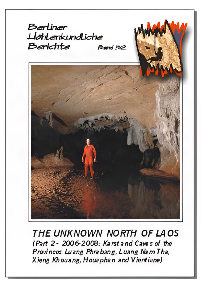
143 pp, colour photo tables, numerous maps and surveys; Berlin 2008. Joerg Dreybrodt & Michael Laumanns (Ed.) Presents the results of the 2006 - 2008 international expeditions to northern Laos. Over 27 km of cave passage from 59 caves. Includes a study on the water chemistry of the caves in the Virngxai area as well as a detailed biospeleological overview on whole Laos. In English language with a German and French abstract. Before the publication of Dreybrodt & Laumanns (2005), which summarises the exploration done between 2000 and 2005, northern Laos was virtually unknown to spelaology. Only a few reconnaissance projects were conducted prior to 2000 in the province of Luang Phrabang. The afore-mentioned publication provided information on 24.3 km of cave passages from 68 caves. In the framework of the "Northern Lao-European Cave Project" (www.laoscaveproject.de) the investigations were continued in 2006 (Louang Nam Tha province, Vieng Phouka), 2007 and 2008 (mainly Houaphan province, Vieng Xai). In the Houaphan province (Vieng Xai) the communist Pathet Lao had its headquarters for 9 years during the Vietnam War. Extensive military and logistical use of caves was made in this heavily bombed region, including underground cave bunkers for the communist party leaders and subterranean hospitals. These historical cave sites are maintained as national monuments and symbolize the birthplace and rise of the communist party of Laos. The caves attract a growing nuuber of foreign visitors. Underground river courses with huge and beautifully decorated cave passages are abundant and many of them are through caves including the 4.5 km long Tham Nam Long as well as the 3 km long Tham Nam. Nine other caves were explored in 2007 yielding a total of well over 10 km of mapped passages. During the 2008 speleological project 6.7 km of passage from 22 caves were added in the same area, including Tham Ma Liong at 1,565 m of length. The 2008 project was subject of a professional film documentary by ARTE TV channel. Another caving area north of Vieng Thong was briefly visited in the Houaphan province. This region belongs to the Nam Et Phou Louey National Park from where several caves were described by environmental projects with emphasis on eco-tourism. Three days yielded over 2 km of passage from three caves, including the unfinished Tham Thia Thong where about 200 m of passage needs to be added to the already surveyed 1.2 km. Many more caves await exploration. The remaining three of the 15 cave kilometres mapped during the 2007 project came from other regions, mainly from the Phou Khoun area (Luang Phrabang/Vientiane province) where the 2 km long Tham Deu-Tham Dout system consists of two unconnected river caves. Overall, 51.3 km of cave passage from 136 caves has been surveyed to date in northern Laos. This publication reports on the findings of the years 2006- 2008.
51 pages, cave descriptions, cave surveys and maps, full color print; Berlin 2008. David Checkley (Ed.) A comprehensive report setting the standard on the sustainable use of caves for tourism in developing countries. Includes an in-depth geological and spelaogenetical description as well as a plentiful of photographs illustrating possible guided trips through this impressive lava caves, and costing tables for making the caves accessible to tourists. In English language with an abstract in French and German. This report describes the extensive lava tube caves of Mt. Suswa, a dormant volcano in the Eastern Rift Valley of Kenya, known locally as "Oldoinyo Nyokie" -- The Red Mountain. It is the result of a project carried out in June 2007 to map, photograph and outline a strategy for turning selected caves into show caves to attract visiting tourists. It contains detailed cave surveys, cave descriptions and colour photographs, with costed outline engineering plans for the initial development of individual caves. Background information is also provided on the history and exploration of the caves, the geology of the area and the thinking behind the tourism initiative by the indigenous Maasai community, to develop Mt. Suswa as a visitor attraction. Detailed descriptive tours through the caves are also provided, to form the basis of interpretive tours by local cave guides in the future.
4-6 week delivery. 464 pages, zillions of cave descriptions, cave surveys and maps; Berlin 2008. Michael Laumanns. The "Yellow Pages" of caving in Africa. Each country is presented in detail including 3 maps (topography, geology and karst occurrences) as well as a description of the geological settings, the history of speleological exploration, a detailed list of the longest and deepest caves (incl. surveys), a list of useful addresses and an in-depth bibliography.Vol. 28 covers: Introduction & Algeria - Guinea (154 p.).Vol. 29 covers: Guinea-Bissau - Namibia (158 p.).Vol. 30 covers: Niger - Zimbabwe & General References (152 p.).In English language. With a German and French abstract in vol. 28. In 2002 the "Atlas of the Great Caves and the Karst of Africa" was released in this series (Laumanns 2002a, b, c). The atlas has been an unexpected success and I was surprised by the appreciation and support of the many readers. The atlas indeed became a speleological standard reference work that reached a reasonable distribution to serve for the further underground exploration of the "dark continent". You all have made this possible and it was a pleasure for me to experience that four years of in-depth literature research, writing, drawing, and extensive communication on a world"wide scale was not all in vain! Of course, speleological exploration continues steadily, which consequently rise the question whether the 2002 "Atlas of the Great Caves of Africa" shall be considered to be a one-time effort or shall lead to a continuous source for providing information on caves and karst of Africa. And, if the latter alternative is chosen, what would be the best way to continue? Intensive discussions with contributors resulted in a first and a second update of the "Africa Atlas" (Laumanns 2005; 2007). However, the amount of new information also led to many changes in country chapters that could not be included in the update volumes. Furthermore a third update would have scattered the data creating a lack of overview. Consequently, it was decided to release a second edition of the Atlas. In case experts on a specific country will detect inconsistencies or faults in a specific country chapter they are hearty invited to contact the author to provide for amendments. The "Atlas of the Great Caves and the Karst of Africa", is based on the "Atlas of the Great Caves of the World" (Courbon et al. 1989), and on the "Atlas des cavites non calcaires du monde" (Chubert & Courbon 1997). A lot of geological and tectonic information has been gathered from the excellent publication "Limestone and Dolomite Resources of Africa" (Bosse et al. 1996), which is a unique source of knowledge on African carbonate rocks (ISSN 0341-6429, available from the Bundesanstalt fur Geowissenschaften und Rohstoffe, POB 510153, D -- 30631 Hannover). For the 2nd update a brilliant publication by P. Van Straaten (2002) -- called "Rocks for Crops: Agrominerals of Subsaharan Africa" -- was also used to locate possible limestone and dolomite occurrences. The latter publication also mentions many bat guano deposits directly linked to caves. Furthermore a "Geological Atlas of Africa" has been published by Schluter (2006), which will be used for future updates of the "Atlas of the Great Caves and the Karst of Africa". The Speleological Abstracts, published annually by the UIS, served as source for publications after 1980. Furthermore, valuable information on the latest French speleological campaigns in African countries was taken from the annual reports of the "Commission des relations et expeditions internationales" (CREI) published by the Federation Francaise de Speleologie. In the reference lists the articles that have been seen by the author are printed in italic letters. All north direction arrows on the cave maps refer to magnetic north. Inquire for individual volumes.
158 pages, many maps & surveys; Berlin 2008. Herbert Daniel Gebauer. There ARE caves in the Deccan! Over 170 cave and man-made cave sites, the majority of which are not yet surveyed. Includes cave diving sites. An indispensable standard reference work on north-central India. 24 cave surveys, over 500 annotations and a 40 pages long bibliography. The Indian Union state of Madhya Pradesh covers parts of the geographical heartland of India on the northern edge of the Deccan plateau. So far, most of the known karst and cave areas in Madhya Pradesh are found in the sedimentary rocks exposed in the Vindhyan Ranges where true caves both in limestones and sandstones have become known along with a stunningly large nuuber of rock shelters and rock art sites in the vicinities of Bhimbetka, Pachmarhi and many other sites. This volume describes over 170 cave sites and man-made caves, most of which still awaits exploration.
75 pages, many surveys and maps; Berlin 2008. Michael Laumanns; Akko Rasch & Philippe Audra. The complete overview about karst and caves of Iraq, including the results of a 2007 Kurdish-German cave project yielding the new longest cave of Iraq (Kuna Kamtiar, 5,060 m). With a detailled description of the hypogenic sulphidic spelaogenesis. In English language, with a French, German, Kurdish and Arabic abstract. Not too many cavers will seriously think about going to Iraq at the moment. However, there is a different part of Iraq existing where terrorists and kidnappings are unknown and where people are very hospitable to foreigners: the autonomous region of Kurdistan in the northeast of Iraq. The famous Shanidar Cave from where Neanderthal burials are known is located here. Due to favourable circumstances a Kurdish-German cave surveying project became reality in Octuber/November 2007. This was carried out at the invitation of the Kurdish Minister of Tourism and had brilliant logistical support by the Museum of Antiquities in Sulaimania. Within 3 weeks 21 caves with a total passage length of 8,115 metres were mapped, firmly establishing Kuna Kamtiar as the longest cave of Iraq currently 5,060 m in length. The cave is a complicated network of fossil rift passages created by sulphuruc acid water. Another highlight was Tirshawaka, a limestone cave with a sulphuruc spring inside. The sulphuruc acid has dissolved the carbonate rock and has produced a crust of replacement gypsum that covers the cave's roof and walls. The source of the sulphur is supposed to be an underground hydrocarbon deposit. Exploration of Tirshawaka was stopped in wide open river passage due to lack of time. In order to allow a better understanding of the very special mechanisms of sulphuruc cave development the present report also contains a general contribution of hypogenic sulphidic cave spelaogenesis by Philippe Audra (University of Nice, France). The cave potential in northeast Iraq remains very high and the local authorities are keen to conduct further investigations. This report also provides a general overview about the caves outside the Kurdish regions of Iraq.
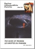
The stand of play (as at March 2007) on the lava caves tube of Rwanda. Replaces volume 11 and 15 of this series. Includes the new longest cave of Rwanda (Ubuvumo Bwibihonga, at 4,530 m of length). Describes more than 72 caves with a passage length of over 25 km. Bi-lingual English/French with a German abstract.
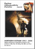
4-6 week delivery time. 212 pages, numerous maps & surveys; Berlin 2007. J. Masschelein; V. Coessens; D. Lagrou; M. Dusar & Tran Tan Van (eds.). Nothing less than over 92 km of passages from 270 caves. Including the deepest cave of northern Vietnam (Cong Nuoc, -600 m). A standard reference work on karst and caves of northern Vietnam. In English language, with a German, French, Flemish and Vietnamese abstract. This report has been compiled from the results of eight Belgian-Vietnamese speleological expeditions to the NW of Vietnam between 1993 and 2006. Karst and caves of five provinces were studied with the provinces of Son La and Lai Chau having been subject of the most detailed investigations, which have led to a long-term development project in both provinces. During the expeditions 270 caves were explored. In total over 92 km of cave passages were surveyed. Amongst them is Cong Nuoc Cave in the Tam Duong area at a depth of -600 m, currently the deepest cave on the mainland of Southeast Asia. The longest cave surveyed so far is the 2,920 m long Noong Khat. 24 caves at a length of over 1 km were found. 265 caves were mapped in the provinces described in this publication. Two other caves were also added to the list of investigated caves: Xa Xa Pin 2 in the Dong Van area, surveyed by a previous Italian expedition, as well as Cau Cuoi in the Yen Bai province. On the way between Son La and Hanoi two more caves (Co Du and Hang Nghiem) were explored in the Moc Chau area in 1997. In 2001 a further cave (Nam Phe 1) was surveyed in the Nam Phe area of the Tam Duong region, which is located north of the areas that were studied in the Lai Chau province. This brings the total of described caves to the nuuber of 270.
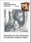
66 pages, maps & surveys; Berlin 2006. Herbert Daniel Gebauer. This report deals with the karst and caves of the most northern Indian Union State. 128 sites - mainly karst caves but also some man-made caverns - are described in detail. 28 other caves are described from the Arki area, where the first European post-WWII caving excursion to South Asia was conducted by a team around E.A. Glennie in 1970. The majority of these caves still awaits surveying. The report has an in-depth 15 pages long bibliography and over 230 explanatory footnotes. In English.
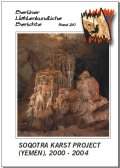
69 pages + foldable maps, colour photo tables, numerous maps & surveys; Berlin 2006. Peter De Geest (ed.). Report of six Belgian speleological expeditions to the island of Soqotra, which so far have yielded 22.7 km of passages from 28 caves -- including Giniba Cave at 7.5 km. With many cave maps and detailed chapters on the investigations on biospeleology, archaeology and spelaothem dating. In English language with abstracts in French, German, Dutch as well as in Arabic. This volume presents a summary of the Soqotra Karst Project (SKP) -- an ongoing multidisciplinary speleological investigation, focused on the island of Soqotra (Yemen). Palaeoclimate, biospeleological, archaeological and sustainable development studies are being conducted by Belgian experts in close co-operation with several Yemeni and other international project partners. This report is based on the recent "Soqotra Karst Project 2000-2004" (SKP 2005) publication that has been primarily released in Dutch and covers the six expeditions made by the SKP to Soqotra Island through Deceuber 2004. Since the first visits in 2000, a total of 28 caves have been mapped yielding 22,707 m of passageway. The longest cave explored so far is Giniba Cave at 7.5 km, while the deepest is Pit Cave (-145 m). Twelve more caves were visited but not surveyed, however three of them were sketched. Some of the caves provide significant freshwater resources. The scientific achievements with regard to spelaothem dating are briefly explained, together with the biospeleological discoveries and intriguing archaeological remains found underground.
67 pages, maps & surveys; Berlin 2005. Herbert Daniel Gebauer. The whole Northwest of India is dealt with in this volume. 129 caves, some man-made caverns and wells are described in detail. Many cave surveys. 15 pages of bibliographical references, a glossary and about 170 footnotes. In English language. Special Order.
166 pages, many cave surveys, maps and B&W photos; Berlin 2004. Herbert Daniel Gebauer. The up-to date standard reference on karst and caves of Afghanistan. All the known 278 Afghan caves and numerous man-made rock-chaubers are presented in detail on the basis of nearly 700 bibliographical references. Extensive annotations with about 770 footnotes.With a very extensive list of references, an alphabetical name register, and with a cave list according to provinces.In English language. After 25 years of military invasions and civil war, cavers may get inspired by learning that tourists "particularly backpacking Japanese coming to see the Buddhas, are drifting into Bamiyan (COHEN 2004: 165)". To recollect some aspects of the speleological knowledge on Afghanistan that was already gained, a nuuber of 278 natural caves and rock shelters, man-made rock chaubers and other "cavish" items were compiled from 693 bibliographical references and listed in alphabetical order. The initial attempt to sort entries by provinces and district was given up. In the past, the administrative divisions of Afghanistan have changed too often to invest into the "32 Province 329 District administrative model" suggested by the United Nations.
56 pages, cave survey (atlas sheets) and colour photo tables; Berlin 2004. S. Arshadi & M. Laumanns. In 2003 a joint Iranian-Swiss-German speleological project firmly established Ghar Katalehkhor (Zanjan province) as the currently longest cave of Iran at 12.860 m, 1.250 m of which are accessible for tourists.This report gives a detailled overview about the physical spelaology and the spelaogenesis of the cave, that has unique spelaothems and fossil deposits.In English language. With an abstract in German. A speleological project in September/Octuber 2003, supervised by the Geological Survey of Iran (GSI), and supported both by the GSI and the government of Zanjan province, firmly established Ghar Katalehkhor (also called: Ghar Kotalehkhor) as the longest cave of Iran at 12.860 m in length. The surveying team consisted of four participants: Mr. H. Akbarzadeh (GSI), Mr. Javad Ashjari (Geological Department of Shiraz University), Mr. M. Laumanns (Germany) and Mr. Reinhold Scherrer (Switzerland). The work within the Zanjan provincial government was co-ordinated by Dr. S. Arshadi (Iran/Germany). Ghar Katalehkhor was discovered in 1965 by mountaineers from Hamadan. It is an anastomotic multilevel cave with a large main gallery, many coulisses, parallel passages, much breakdown and extensive calcite formation, as well as superb crystals that cover complete chaubers for dozens of metres (e.g. the approximately 100 m long "Wedding Hall"). The cave is open to tourists and has a 1.250 m long visitor path that is partly made up of steel bridges. From the terminal point of the show cave the visitors have to walk back the whole distance to the entrance and thus negotiate an underground walk of 2.5 km. Ghar Katalehkhor is developed in Oligocene/Miocene limestone in the northern flank of an anticline. It is suggested that the cave was mainly created by phreatic corrosion in a still water milieu. A spelaogenetic model is presented in this report.
82 pp, photo tables and many surveys, 3 annexes; Berlin 2002. M. Denneborg, M. Laumanns, M. Schnadwinkel & St. Voigt. Report on the first caving expedition ever to Cambodia -- and the only one, which has been conducted up till now. Detailled description of the caves in the Kampot district (southern Cambodia). 11,5 km of mapped passages in 37 caves. In English language with a French abstract. Between 27th of Deceuber 1995 and 2nd of February 1996, a German-Cambodian exploration project on Cambodian caves and karst phenomena took place in the south of Cambodia. It was the first speleological project at all that has been carried out in this country. The German project participants were Michael Denneborg, Bjorn Grun, Herbert Daniel Gebauer, Michael Laumanns, Matthias Schnadwinkel und Stefan Voigt. During the campaign 11,5 km of caves were explored and surveyed and three ancient cave Shiva temples from the 6th century (Funan period) were discovered. This successful outcome was the result of great the personal support from the minister of culture Mr. Nouth Narang and the effective organisation by his personal secretaries Mr. Khuon Chamroen and Mr. Ek Buthan who accompanied the campaign the whole time. We are also acknowledging the brilliant technical support from the German ambassador Dr. W. Treskow and his staff. The fundamental basis for the success of the campaign was the generous financial funding by the German Ministry of Foreign Affairs. The speleological campaign had four aims: * Exploration and survey of the Cambodian caves * Documentation of archaeological objects * Recommendation for the use of the caves for touristic purposes * Training of local staff The results can be summarised as follows: During the campaign 37 caves with a total length of 11.5 km were surveyed. The caves are located in the Province of Kampot. The longest Cambodian cave is Roung Dai Ho near Kampot at 1.8 km of length. The main karst areas of Cambodia near Battambang and Stoung Treng could not be visited for safety reasons. We recommend another campaign in this area when access is possible. In three caves Roung Vihear Tuk, Roung Vihear Preah, Roung Prasat ancient Shiva temples and artefacts from the 6th century AD were found, which show evidence of unexpectedly strong influence by Indian culture in this area. We are sure that further scientific research will provide new knowledge about this period of Cambodian history. For three caves we consider a good potential as tourist show caves. Necessary for an inevitable long-term benefit is the careful conversion to a tourist cave and the appropriate training of tourist guides. One cave is the Roung Dai Ho together with nearby Roung Nakta. The caves are situated near the town of Kampot close to a road. An interesting round trip can be arranged easily in the Dai Ho cave. Another cave is Roung Bat Khteas together with Vihear Tuk. Roung Bat Khteas has some impressive galleries and flowstone passages. Furthermore, one of the three ancient temples discovered is located in the nearby Vihear Tuk and the surrounding countryside is very scenic. The road to the caves has to be improved. The cave Roung Preah Nipean near Kampong Trach with a modern temple and Buddha statues gives the opportunity to develop a show cave with very little effort in a scenic countryside. During the whole campaign Mr. Khuon Chamroen and Mr. Ek Bhutan accompanied us. They were introduced to the basic principles and technique of cave exploration and documentation. For a further development of the tourist potential of the caves we highly recommend future instruction in Germany. Part of this instruction should be: principles and basic technique of setting up a show cave such as construction of paths and stairs/ladders according to appropriate safety standards, enlargement of passages, illumination, advertisement, training of guides, nature and cave protection. A participant of the campaign in Cambodia, Stefan Voigt, is member of the society "Kluterthohle e.V." so that a great part of the training could take place under his supervision (the Kluterthohle is a large show cave in Ennepetal/Germany which is also used as an underground sanatory). The training program should include the visit of show caves in Belgium and France and information about their development.
40 pp, colour photo tables, many maps and cave surveys; Berlin 2001. H. Daniel Gebauer, Betsy Chhakchhuak & Neil Sootinck. 61 cave locations from the most remote Union State of India near the Burmese border are presented in this report, which is based on two reconnaissance projects in 1999 and 2001. With detailled topographical and cave distribution maps in colour.In English language. Due to the unsuitable geology -- limestone is as good as absent -- was Mizoram not considered as a promising caving area (GEBAUER 1996, 1997). In Mizo folklore, legends and myths, of course, all sorts of real, fictive and would-be caves played an important role since time immemorial. All the known caves of Mizoram are of exceptional origin. Generally said, there are two distinct modes of cave development: First and most widespread, by mass wasting (solution, abrasion) and second, by mass dislocation (gravitation, tectonics). Many caves are exclusively of tectonic origin and result from tension cleavage of the compact host rocks, which are sandwiched in between shales. As far as currently known (May 2001) there exists not a single true karst cave. The only known river cave (Bak Puk, South Lungrang) is predominantly a result of piping failure.
43 pp, many b&w-photos and surveys, annexes; Berlin 2001. M. Laumanns, S. Brooks, I. Dorsten, G. Kaufmann, M. Lopez-Correa & B. Koppen. In 2000/01 a German/British team explored Ghar Alisadr, which is the longest cave of Iran at 11.440 m. This volume gives a detailled description of Ghar Alisadr and adjacent caves. A chapter deals with the stand of spelaology in Iran. In English language. The speleological project "Topography of Ghar Alisadr (Hamadan, Iran)" was conducted in two phases that took place between the 1st and the 19th of Deceuber, 2000, and the 3rd and 22nd of August, 2001. It involved participants from the Geological Survey of Iran (GSI), the Alisadr Tourist's Company and a team of German Spelaologists (I. Dorsten, Dipl.-Geogr. K. Gladis, Dr. G. Kaufmann, Dipl-Geogr. B. Koppen, M. Laumanns, M. Lopez-Correa and T. Muller) and one British spelaologist (S. Brooks). The major aim of the project was to survey Ghar Alisadr (Alisadr Cave) and produce a map of cave passages. Ghar Alisadr belongs to the precious natural heritage of Iran. It is currently one of the 10 most important show caves of the world. Several written sources had indicated that the accumulated length of all the cave passages of Ghar Alisadr is supposed to be around 11-14 km. However, the length quoted was merely an orally stated value that has never been verified by a proper survey of the entire cave according to international standards. Before this project took place, only an incomplete map of the touristic section of the cave was available, based on the work of Hamadan mountaineers (published in Forti 1998). Further discoveries were merely sketched. The successful 2000 and 2001 projects resulted in 11.440 m of mapped passage length for Ghar Alisadr and have left the cave with only some minor open leads. Hence, Ghar Alisadr is currently by far the longest cave of Iran that is surveyed according to international standards. Difficult weather conditions with heavy snowstorms during the 2000 project prohibited extensive field excursions at that time, which were instead done during the 2001 project. Besides an examination of the area close to Ghar Alisadr a nuuber of other caves (Ghar Sarab, Ghar Soobashi and Ghar Gamasiab) were studied as well as karst springs and volcanic occurrences. The observations led to a supposed model of karstification and cave development in the Alisadr region.